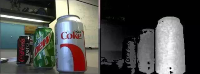
Each pixel inside the ToF camera can get a corresponding distance, and the distance measured by all the pixels constitutes a depth map, as shown in the figure below. The left is the original image, and the right is the corresponding depth image.

It can be seen that the depth map is actually a grayscale image, which is a three-dimensional map: the horizontal and vertical coordinates correspond to the pixel position, and the grayscale value of this position corresponds to the distance of the pixel from the camera. Therefore, each pixel in the depth map can represent the three-dimensional coordinates of a point in space, so each pixel in the depth map is also called a voxel.
